Wednesday, September 21, 2011

Kaufman

After the service at College Mound, Sherry and I went to Kaufman with Tim and his family. We looked for the site of my Grandmother's house in Kaufman, and with a minimal amount of wandering around, found it. We knew that the house had burned down, but we wanted to at least visit the site. Tim and I had both been there as children. This was not really "the old homestead." Our Grandmother had bought the house and moved into town sometime after our grandfather died in 1946. Most of her children were grown and gone by that time. But she lived there until she died in 1966. Our Aunt Jane continued to live there for a number of years. But the house was essentially unmaintainable. Eventually Aunt Jane moved into a modern duplex and the old house was sold. By the time it burned down, the family had had no connection with it for perhaps twenty years.

Next we went to Uncle Jack's farm, about five miles outside of town. This was a real nostalga binge. Tim and I had both visited there as children. Uncle Jack died in 1994, but Aunt Francis continued to live there until about five years ago, when she moved into an assisted living facility, where she still lives. My father and I visited her at the farm, perhaps ten years ago.

The house and the outbuildings are still there, looking very much like they looked when I visited as a child. I have posted some pictures below.

The shed behind the house.


Tim examines the old tractor.


The barn.

I remember being inside the barn as a child when it was well populated with animals, and climbing into the hay loft.


We drove into town for dinner at the Jackson Street BBQ, on the square. Tim had read good reviews of this restaurant on the Internet, so we decided to give it a try. A good decision! The smoke and barbecue smell outside would have pulled me in even without the reviews.


We were met with the sound of Bluegrass music. By pure luck we had gone there on a night when local musicians met to play and sing. There were about a dozen musicians, playing guitars, banjos, and mandolins. I said to Diana as we went in, "This is the real thing!"


They played and sang with no written music. All acoustic. It sounded absolutely professional.


Percussion was provided by a washboard. This was not a joke instrument. This was serious music. The guy standing, in the picture below, is playing a wash tub bass. There is a single string, which is barely visible in the picture. He controls the pitch by pulling back on the top of the stick to change the tension. It sounds pretty much like a real bass. I was amazed.

They played and sang a song that I remembered from my Grandfather's funeral in 1952. In the funeral the song was sung by a quartet with piano accompaniment, but I recognized the tune immediately. I remember just a few of the words. "Cheer up my brother. ... We'll understand (it all by and by.)" But that was enough to find the song on the Internet. I hadn't heard the song since 1952, but there are multiple performances on YouTube. The one I like best is by Johnny Cash .

We stayed there listening to the music until they started to close the restaurant. The waitress took this picture for us.

Tuesday, September 20, 2011

Aunt Jean

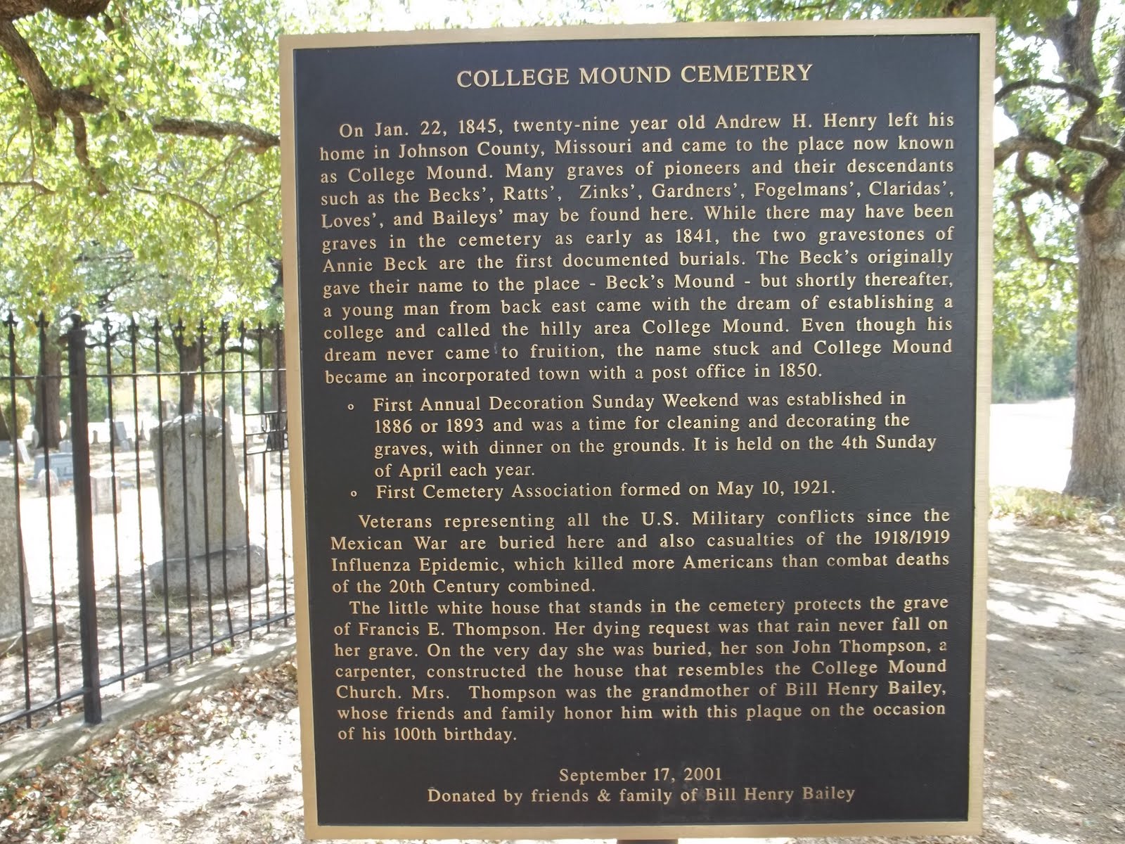
On Tuesday, September 13, my cousin Reba called to let us know that her mother, my Aunt Jean, had passed away. There would be a funeral in Nederland, Texas, where she had lived, and burial at College Mound, Texas. Sherry and I traveled to Texas to attend the graveside service. Aunt Jean was the last surviving child of my paternal grandparents, my father's last surviving sibling.

Reba's husband, Rev. Mark Mark Baliles, conducted the service. Happy stories from personal experience as a member of Aunt Jean's family. Sympathetic, honest, unvarnished recall of the hardship of the final chapter of her life. Wonderful Bible passages about death and resurrection.

The sadness of saying goodbye was tempered by the joy of being with family members that we have rarely seen.

Sherry and I returned to College Mound on Monday and took some pictures, which I have posted below.


A sweet little country church.


Monday, September 5, 2011

Micanopy

Sherry and I visited Micanopy yesterday. Micanopy (pronounced Mick-can-oh'-pee) is a pretty little town near Gainesville, noted primarily for antique shops. It was the first inland settlement in Florida. Bailey White writes about driving 200 miles each year to visit the book store there. Mr. Brisky and his book store are still there. We poked around in the store for a while, looking but not buying. It was just as Baily White described it.

I had often wondered about the meaning of the name Micanopy. Then a few days ago I read an account of the Dade Massacre. This was the opening of the Second Seminole War, on December 28, 1835, in which Major Francis L. Dade (Miami-Dade county and Dade City, FL) was killed, along with most of his company of 110 soldiers. Major Dade was reportedly killed by the first shot, fired by a Seminole known as Micanopy.

It seemed strange that a town would be named for an enemy combatant. Especially one notorious for having personally killed an American military leader. A roadside plaque in Micanopy resolved the mystery.

Micanopy is not a name, but a title, meaning "Great Chief". The town, which has been continuously settled since 1821, was referred to both as "Wanton" and "Micanope" in its earliest days. The name was officially changed to "Micanopy" in 1834, prior to the Dade massacre.

The town was, in fact, named for the same Micanopy who later led the Seminoles in the Dade massacre, and has retained that name to this day.

Wednesday, July 6, 2011

Escape from New York City

On Friday, July 1, 2011, at about 3:00 P.M. we left our hotel in midtown Manhatten heading for our next stop in north Jersey. We were not going far. We had a hotel reservation in Red Bank, New Jersey, near the Garden State Parkway. We had made a hotel reservation fairly close to New York City because we wanted to spend most of the day in the city.

We had a Garman GPS navigator that had proven fairly reliable at getting us where we wanted to go. I made the mistake of trusting it to tell me the best way out of the city. The navigator directed us toward the Holland Tunnel . Seemed like a reasonable idea since we were starting on the West Side. But the street in front of the hotel (40th Street) is one-way east. Following the navigator's directions, I ended up on the East Side, going north on 1st Avenue.

The navigator keeps trying to get me to head back to the west, toward the Holland Tunnel. I keep missing the turns because I can't see the street name until it is too late to turn. Traffic is not too bad here.

After I miss the turn onto 57th Street (westbound), the navigator recalculates and tells me to turn left on 61st Street. This seems like a dumb suggestion, because 59th Street is also westbound. Why wait until 61st Street? I turn left onto 59th Street, heading west.

Big mistake! 59th Street immediately forces me to make a U turn onto the approach to the Queensboro Bridge. There is no exit.


Click on the image to see an enlarged copy.


We get a good view of the Roosevelt Island Tram from the Queensboro Bridge. (This is what my family refers to as "Seeing a little bit of ____," something that has happened more than once.)

So now we are in Queens, to the east of Manhatten. But the navigator still wants us to take the Holland Tunnel on the west side. It accurately guides us to the Manhattan Bridge. Traffic back into Manhattan is heavy and slow, but it does keep moving. We get to see a little bit of midtown Manhattan from the bridge.


The Manhattan Bridge drops us off at the Bowery and Canal Street. We get to see a little bit of Chinatown. The navigator still wants to get us to the Holland Tunnel, across town.


Now the navigator leads us into the worst traffic jam I have ever seen. This is the city that invented gridlock. We get to experience it first hand. It's sit still and pull up one car length (when you're lucky.) When a traffic light turns green, we can't move because the street beyond the light is full of stopped cars. Eventually people start to pull into the intersection even though the street ahead is blocked, thereby blocking traffic on the cross street.


We see "To Holland Tunnel" signs, and the navigator accurately tells us the same direction. But we can't move. On the radio we hear a traffic report telling us that there is a one hour delay outbound at the Holland Tunnel. What a joke! At the rate we are going it is a 48 hour delay. And there does not appear to be any escape route. One side street is blocked, with a construction crane in the middle of the street halfway up the block. Others are full of cars sitting still.


Now I'm sitting in the right hand lane of a three lane one way street. The navigator says to turn right, onto another three lane one way street. On my street two lanes can turn, going onto the one way street to the right, which is blocked with traffic. Each time the car in the right hand lane of the cross street pulls up a bit, the car on my left cuts in front of me into the right hand lane of the cross street. In about ten minutes, three cars do this. I haven't moved. A guy gets out of the second car back from me and comes up and taps on my window. Against my better judgement, I lower the window. He politely asks me not to let them do that. (In New York City, you have to drive like a New Yorker!)


Drawing on my experience from years ago in Boston, I get my bumper in front of the bumper of the next car trying to cut in front of me and manage to make the right turn.


At the next intersection, I eventually find myself at the light in the right hand lane. The cross street is one way to the left. The light changes to red for my direction. Miraculously, the cars ahead of me move ahead leaving the intersection clear. The pedestrians have not yet reached the middle of the intersection. I pull into the intersection and turn left across the two lanes of stopped traffic. The street ahead is farily clear. I have no idea where it goes, but it has to be better than where I am.


Once I am out of the gridlock area, the traffic is not too bad. I think that's because I am headed back to the east and most people are trying to go to the west to the Holland Tunnel. I find my way to the Brooklyn Bridge eastbound. Traffic is not too bad in this direction. (Who wants to go to Brooklyn for the Fourth of July?) The bridge dumps us onto the Flatbush Avenue Extension.


I'm thinking that my best bet at this time is to take the Verrazano-Narrows Bridge to Staten Island, and from there take state route 440 over to New Jersey and the Garden State Parkway. Actually, I had thought of taking this route earlier, before succumbing to the instructions of the navigator, just because I wanted to go over the Verrazano-Narrows Bridge. I should have listened to my intuition.


The Verrazano-Narrows Bridge is magnificant. Once the longest suspension bridge in the world. It was a thrill seeing it up close and driving over it. Traffic was not bad on this route. We arrived at our hotel in Red Bank, NJ, beside the Garden State Parkway about 6:30 PM. Altogether it had taken about three and a half hours to make a trip that would have taken perhaps one hour under normal traffic conditions (even normal conditions for New York City!)


Driving through New Jersey and Delaware the next day we saw a lot of serious traffic congestion, but it was all in the opposite direction. People trying to get to the beaches. I can't imagine wanting to go to a beach badly enough to endure this traffic. Fortunately we didn't have to.

The City Quilter

On Friday, July 1, 2011, at about 1:00 PM, we checked out of our hotel on 40th Street and walked down to The City Quilter on 25th Street. This was a pilgrimage for Sherry. We had walked here on a previous trip, but it was closed. Sherry hoped to find some fabric here that she had been unable to find in Tampa.

Sherry inside The City Quilter.


It turned out not to be as big a store as we have at home. (A bit of a disappointment!) But Sherry did find the fabric that she was looking for.

They had some very nice quilts on display.

(Click on the image to see a much better copy.)


Quilts based on New York City postage stamps.


After The City Quilter we started back to our hotel to collect our car and baggage. Fortunately we could leave the car parked for up to 24 hours at the same cost even though we had to check out of the hotel by 1:00 PM. We looked for a quaint little offbeat pub for lunch. These are harder to find in Manhattan than you might expect, but we did find one, The Molly Wee Pub at 8th Avenue and 30 Street, on the way back to the hotel. They say that Molly Wee is Irish for "yellow hill."

We had a nice lunch in the uncrowded pub and called the hotel to retrieve our car (30 minutes advance notice required.) It was waiting for us on the street in front of the hotel when we got back.

Now the hard part, getting out of New York City at the start of the Fourth of July holiday weekend. We didn't have any illusion that this would be easy. Traffic on I95 northbound had been seriously congested the day before as we were going south into the city. By "seriously congested" I mean miles of cars more or less sitting still. Getting into the city had been fairly easy, as most people were trying to get out. Getting out of New York City would turn out to be an adventure. But that will be another post.

Tuesday, July 5, 2011

Walking the High Line

On Friday, July 1, 2011, Sherry and I walked the High Line, on the west side of Manhattan. I had read a lot about the High Line and was eager to see it. Here are some photos that we took there. Keep in mind that what looks like ground level is actually about 25 feet above the street.


The High Line is an "elevated park." It's essentially a long sidewalk with lush plantings, built on an old elevated railway. There are numerous access points with stairs and two with elevators.


Click on any image to get a (much better) enlarged version.


Sherry taking a picture of HL23, a new condo building beside the High Line at 23rd Street. We had read about HL23 in a NY Times article (Click on the link to see the article, including a better photo of the building.)


They have left the old rails in some places and incorporated them into the design. I was enormously impressed by the landscape design.


Plants don't look this good by themselves. NYC puts a lot of work into maintaining this park. We saw several workers tending to the plants.


Here is the skyline of Jersey City, across the Hudson River, seen from the High Line.


Looking northeast, Empire State Building in the background.


A wading pool, about one inch deep. We did see some kids in it, in addition to the barefoot adults seen here.

A little bit of NY humor:

This plaque tells the story of the High Line. (Click on the image to enlarge it.)


Monday, July 4, 2011

Connecticut Vacation

We took four days to drive to Connecticut, leaving Tampa on June 20. One objective was to stop over in Fredericksburg, VA, and go to the Blarney Stone Pub, which we had visited and liked on a previous trip to Connecticut. Fredericksburg being about half way, it seemed to make sense to divide the trip into four segments.

We were away fourteen days and drove a total of 3419 miles, including a quick trip up to Maine after visiting with Terry and family. We arrived in Chester, CT, on Thursday, June 23.

The first priority was to catch up on visiting with the grandchildren.


Quinn (with Savannah)


Nuala (with Grandpa Rollins)


On Friday, June 24, we all went to Gillette Castle, a favorite tourist site in the area. The "Gillette" was William Gillette (1853 - 1937), a celebrity actor who was best known for portraying Sherlock Holmes on the stage. No connection to the shaving company.


He was equivalent of a movie star in his time, and made a lot of money. He built this mansion on a choice site overlooking the Connecticut River.

We crossed the Connecticut River on the Chester-Hadlyme Ferry, one of many services threatened by budget cuts in Connecticut. I hope it survives. It is a real treat.


On Tuesday, June 28, we drove up to Boothbay Harbor, Maine. We had been there on previous trips and were eager to see it again.

One of Sherry's favorite sites is this little house overlooking the harbor.


It was foggy on Wednesday. Here is a view of the harbor from our B&B, near the north end of the harbor.


In the background is a footbridge that goes across the harbor near the end. Most of the harbor is on the other side of the bridge.

We had hoped to take a ride on a sailboat from the harbor, but all trips were canceled on Wednesday due to the weather. Instead we drove down the Pemaguid Peninsula, and visited the Pemaquid Point Light .

We climbed up the circular stairway inside the lighthouse into the little room at the top that houses the light. The light is still in use, but was turned off this day due to the fog.

Here are the rocks leading down to the ocean behind the lighthouse. In the fog, the ocean blends into the sky.


It was a good day to be on land!